|
FLOODWATER
MANAGEMENT, |
|
|
|
PAST & PRESENT |
|
By Kashyapa A. S. Yapa |
| I have gathered below a collection of
photographs, showing various forms of landscape transformations,
put into effect by ancient floodplain inhabitants, all over the
American Continent, despite the extreme difficulty in grasping
these monumental works from the ground. I will include
similar, modern projects, within a comparative analysis, in the
future. I would very much appreciate, if you could collaborate,
by sending us information on flood management projects, both
ancient and modern, that are not referred to here.
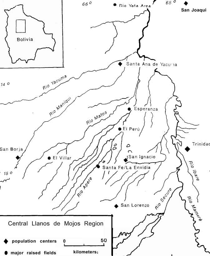
CONTENTS: fishwiers - mojos causeways - mojos
Ridged Fields: |
|
|
A recent attempt to refurbish, or built anew, the
'floating gardens' (chinampas), in swamp areas of the
State of Veracruz, Mexico. Food crops are grown on
fields, raised above the flood level, and the sediments,
accumulated in adjacent canals, provide natural fertilizer.
(from Gómez-Pampa
et al,
1982,
"Experiences in traditional hydraulic agriculture"
in Maya subsistence, ed: Kent V. Flannery, Academic
Press. p. 327-342.) |
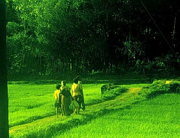
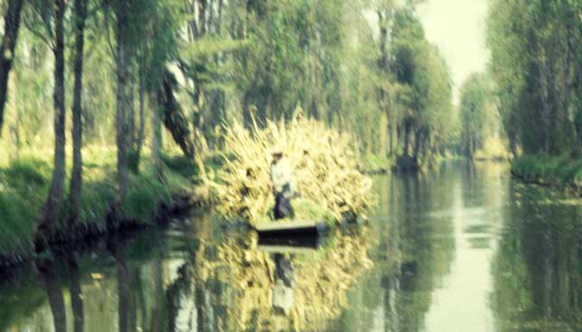
| A chinampa field, still in use, in Xochimilco, Mexico City, Mexico. |
|
|
|
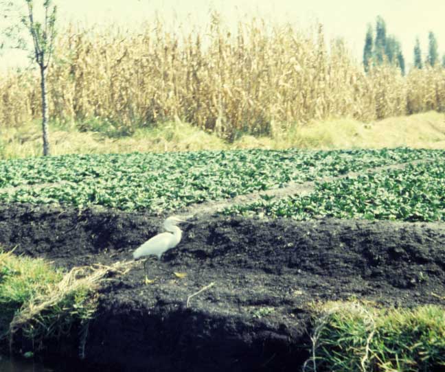
Foreground: Pot irrigation in a chinampa plot of a type of grass for decorations, in Xochimilco. Back: more gardens, raised above ground for better drainage. |
| Long, wide, canals: highways in Xochimilco swamp. The rows of trees, along the canals, protect the edges of 'floating islands' from erosion. |
|
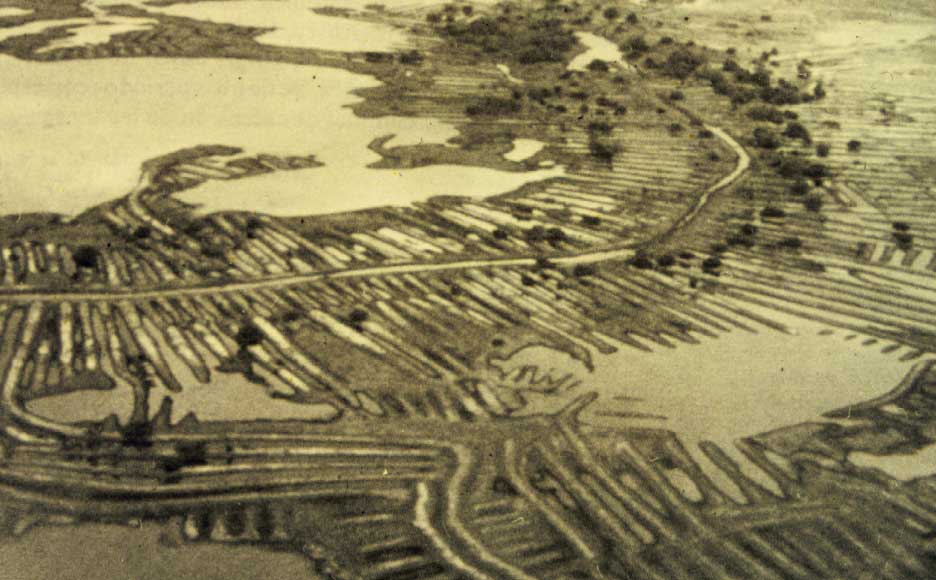 |
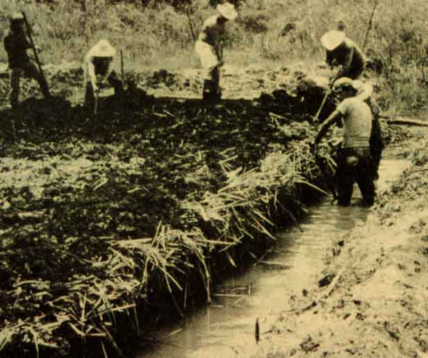
Long canals and raised fields, that converted the lower Rio San Jorge area, of Momposina swamp, in Colombia, into intensive agricultural fields and habitation sites, during Zenu occupation. Some canals brought excess water to the river while others diverted the flood towards natural depressions. (from: p69, Boletin #20, 1988, Museo de Oro, Bogota, Colombia.) |
| A set of ancient raised fields and canals was sectioned by the new alignment of a large canal, in Momposina swamp. (from: p62, Boletin #20, 1988, Museo de Oro, Bogota, Colombia.) | 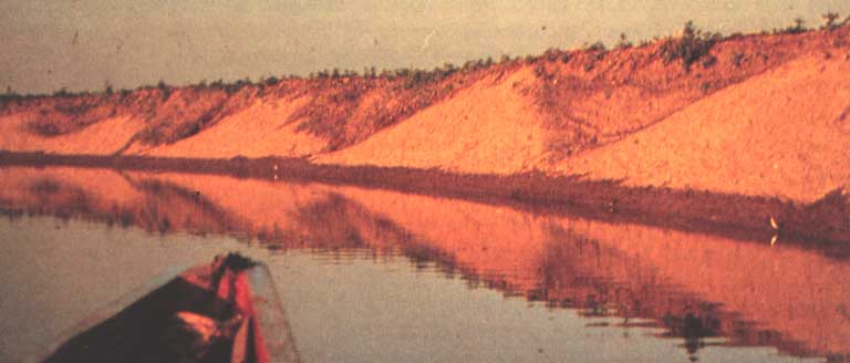 |
 |
Aerial view of camellones and canals at Peñon del Rio site, Duran, Guayas, Ecuador. (from: Michael Muse) |
| A closer view of the same site, in Guayas, Ecuador: foreground - canal, back - trees on the raised field. |  |
 |
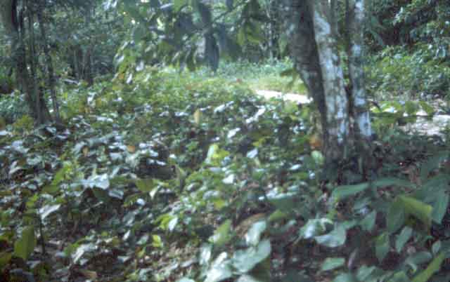
Archaeologist Franklin Fuentes, contemplating ancient ridged fields and canals, in Yumes, Guayas, Ecuador. The recent dam in Rio Daule, keeps annual floods away from these plots, but it provides no respite from El Niño floods. |
|
 |
|
|
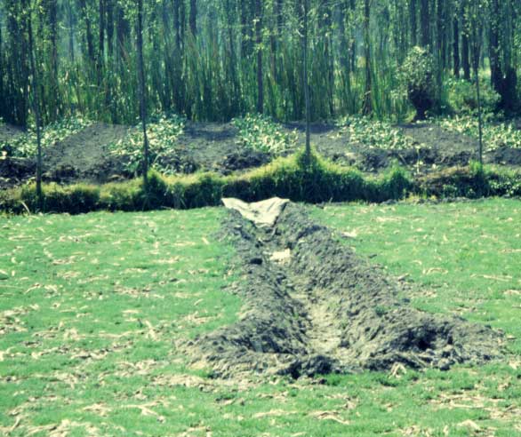
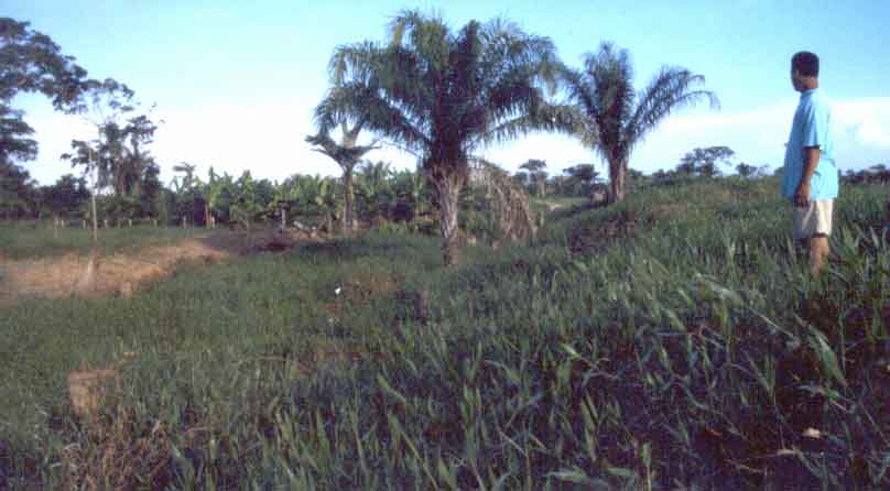
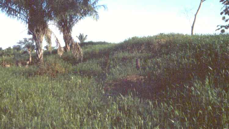
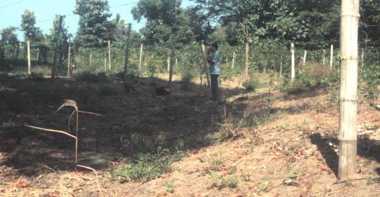
A wide, shallow, canal, surrounding an artificial hill (loma), near Trinidad, Beni, Bolivia. |
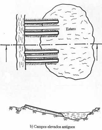
| A sketch showing, how the alternating rows of ridged fields and canals, in the Orinoco flood plains of Venezuela, diverted flood waters from a rivulet (caño - on the left) towards a natural depression (estero). (The section, below, has its vertical scale exaggerated.) |
|
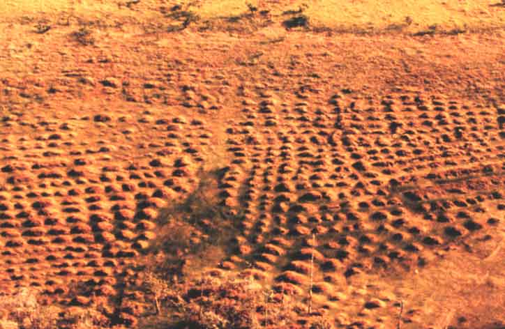 |
Small, artificially raised hills (buttes), that dot, in thousands, the coastal swamps of French Guayana. (from: Stephen Rostain) |
| Fishweirs: |
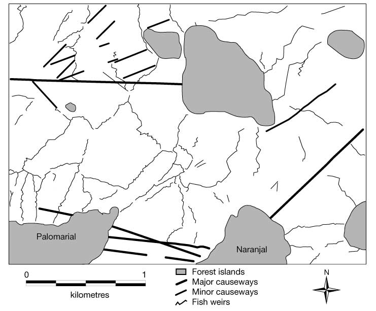
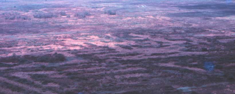
| Oblique air photo showing a long, zigzag dike, interpreted as a fishweir (running diagonally, from left to right), as well as small, round, artificial ponds, in Baures, Beni, Bolivia. The 20-50cm high dikes, changing direction every 10-30m, probably helped trap fish, in this vast floodplain. The ponds probably stored the fish. (from: Erickson, Clark L., 2000, "An artificial landscape-scale fishery in the Bolivian Amazon," Nature, vol. 40819, p 190-4, November.) | 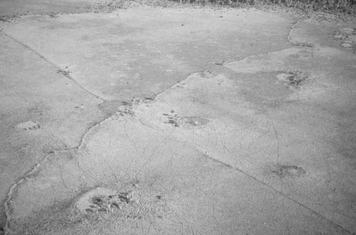 |
|
|
Map shows the artificial dikes between islands of high ground (in blue) in Baures floodplain. Thick dark lines are causeways that facilitate communication. Thin zigzag lines are fishweirs, estimated to be some 1500km long, in total. (from: Erickson, 2000) |
| Causeways (calzadas): |
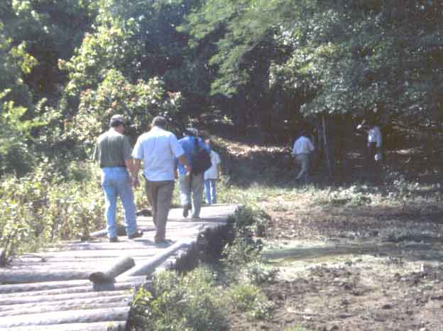
| Long and wide, artificial causeways, facilitated foot traffic between higher grounds (natural and artificial), in the Mojos floodplain of Bolivia. This calzada is near San Ignacio. |
|
 |
Side view of the same calzada in San Ignacio. |
If you would like to begin a discussion, please, write to me |