|
GROUNDWATER MANAGEMENT, |
|
|
|
THE
AMERICAN WAY: |
|
By Kashyapa A. S. Yapa |
|
Last year, the
State governments of Arizona and Nevada, of the United States of
America, reached an unprecedented accord.
The remotely populated Nevada, consumes only a mere
fraction of its allocation of Colorado River water, and its
powerful western neighbor, ever-thirsty California, threatens to
bleed the excess for good.
Meanwhile, Nevada’s not-so-powerful southeastern
neighbor, Arizona, cries out for help because, its recent
population-boom severely depleted its groundwater levels.
The neighborly accord, allows Arizona to feed today, its
dry aquifers, with the surplus water of Nevada who, in turn,
will take out the same quantity from the River, above its quota,
as its demand increases. An
extraordinary act for all these western States, given their
appalling pasts, of voracious groundwater extraction. However,
the indigenous peoples of America have always nourished the
mother earth, with the vital liquid, before consuming the same.
The arid, Pacific coastal belt, has sustained large
settlements, over thousands of years, because the ancient
engineers knew, how to recondition the dry environment, to
support all life forms –its fauna and its flora.
They augmented ground infiltration of water, by slowing
down the surface runoff, and exploited the groundwater, by
moving their cultivating fields closer to it, although, specific
techniques depend on local topography and the availability of
resources. Many ancient
North American desert farmers, kept their valley plots covered,
with fist-sized pebbles ('gravel mulch gardens' - Cordell,
1984), which, among other benefits, also help slowdown the
runoff. The Papago
farmers of Arizona, even today, use branches of desert brush, to
reduce the velocity of the sheet wash, in their nearly level
fields. For the
same purpose, the Hopi and the Southern Sinagua, of Arizona
(Reid & Whittlesey, 1997), as well as the Maya, of the upper
Grijalva basin in Mexico (Matheny, 1982), all of them, contoured
with fieldstones, their gently sloping terrain.
Controlling runoff, in more inclined slopes, require
stronger blockades, like the Metapantli
terraces (piles of earth, backed by a row of Maguey plants -
Denevan, 1980) in Mexico, or like those ‘walls,’ made of
large, non-bonded, blocks of cangagua (hardened earth), in Ecuadorian Andes.
On steeper grades, they built masonry terraces, like
those that scale almost every mountain slope in the southern
Andes, which, not only facilitate cultivable surfaces, but also,
improve the ground infiltration of rainwater.
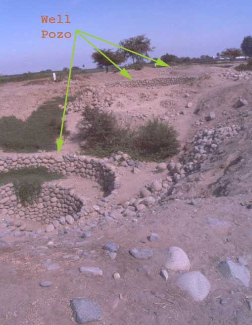
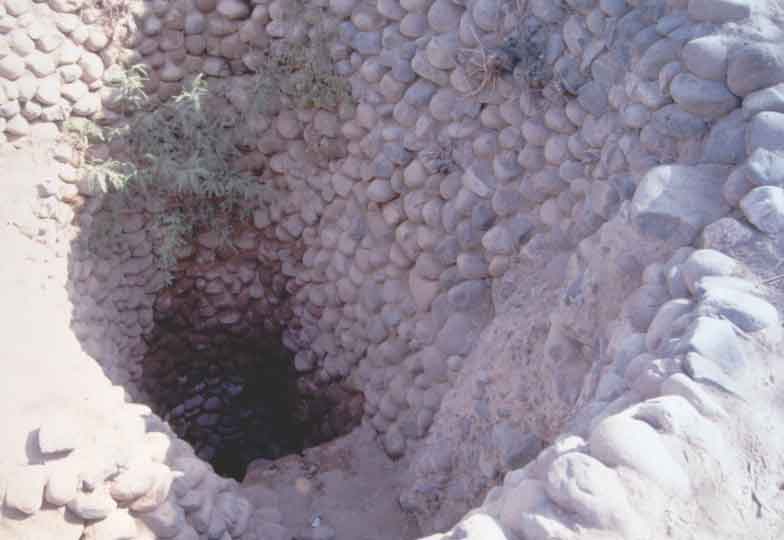
Marca Huamachuco people, in the department of La Libertad,
Peru, had given a perfect demonstration of such: they erected an
artificial terraced mound, at the top of their sacred hill,
Cerro Amaru, to trap a greater part of the scarce rain.
Three, fully stone-lined, bottlenecked wells, called Chiles,
built into the mound, collect the infiltration, and supply the
inhabitants of the Cerro today, just as they helped the thirsty
pilgrims yesterday. |
|
|
|
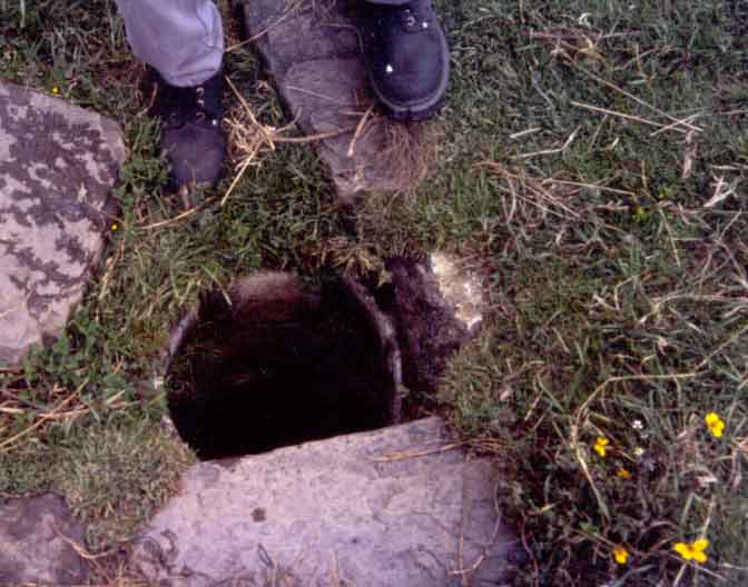
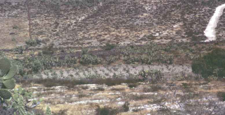
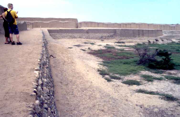
| When
runoff occurs along well-defined stream channels, building check
dams across them slows down the surface flow.
In Pueblo settlements of Chaco Canyon and Mesa Verde, of
southwestern United States, hundreds of check dams blocked many
small gullies, and some, even diverted the water towards their
‘bordered gardens’ (Cordell, 1984).
|
| Hundreds of check dams, like these, in Mesa Verde (Colorado, USA) Anasazi pueblo, blocked stream channels, to trap sediments and augment infiltration. |
|
| Such small
agricultural plots, enclosed by heaps of earth, common in mild,
desert slopes of the USA, and in alluvial fans of the dry,
coastal belt of Peru –where they are called Bancadas
or Canchas (Deza, 1999), provide rudimentary means of trapping the
rain, or the runoff. Another
form of water-trapping gardens exists in the Peruvian high
plains, near Pucará, north of Lake Titicaca.
The lack of water, and the abundance of frost, forced the
indigenous farmers there, to dig an ingenious, albeit very labor
extensive, system of large (90 to 150 meters in diameter),
dish-shaped, shallow ponds.
These qochas,
numbering in the thousands, built at close proximity to one
another, captured a greater part of the precipitation.
The Huarpa/Huari communities, of the semi-arid,
mid-elevation hills, of Ayacucho, Peru, had devised another
system, to store rainwater and canalized water.
They built a number of reservoirs, encircling the wide,
saddle points, among the hills, with thick earth dikes. |
|
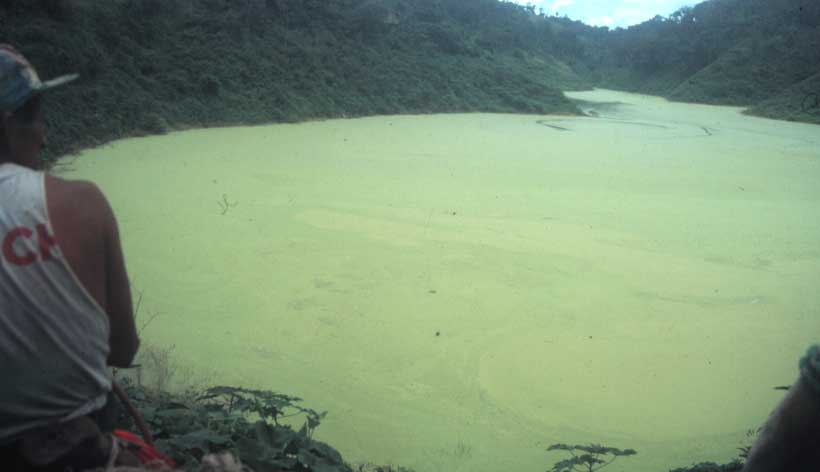
Some 25,000 qochas, 2 to 6m deep (Flores y Flores, 1983), dot this plateau of 384km2 at 3900m elevation, probably dug by Pucara culture (400BC -200AD). As water recedes, farmers grow on small ridges inside the pond, without fears against the frost nor the drought. (Llallagua, Prov. of Azangaro, Dept. of Puno, Peru) |
| One of the four reservoirs (now cacti are planted in the middle and around them), that together, could store up to 20,000 m3 of water (Pérez, 1999), at Tahuacocha, Ayacucho valley, Peru, probably built around 0-500AD by Huarpa/Huari cultures. |
|
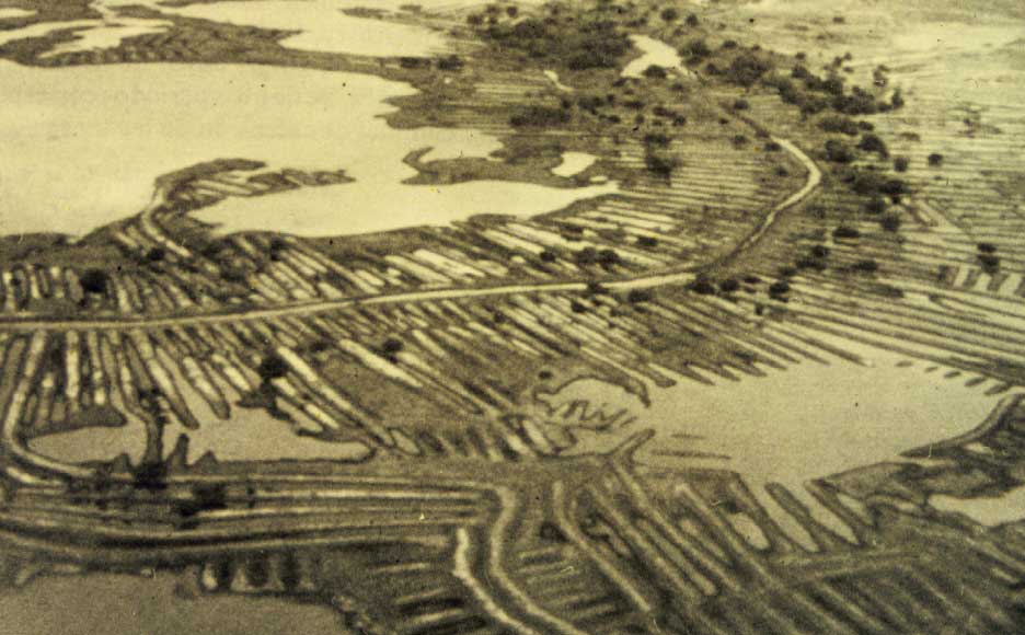
| The South American
floodplain farmers also suffer from the lack of soil humidity,
during the growing season, because of long dry spells.
The ancient engineers found a solution, in what we
consider today, the problem: the floods.
In almost every large floodplain, they implemented, an
integral water management system (Yapa 1997), diverting
floodwaters, towards the natural (or modified) depressions,
using myriad of long canals and levees (camellones),
for storage and gradual infiltration.
Many projects have propped up, in recent times,
pretending to recover land for cultivation, from these swamps,
now abandoned: for example, the Bajo
Guayas Project of CEDEGE (1994), in Ecuador, and the
Multi-purpose URRA I Project (Alzate et al, 1987), in Colombia.
Nevertheless, they become bogged down in their attempts
to imprison the rivers; they ignore the benefits the floods
bring, and thus, leave the small farmers worse-off. |
| Examples of ancient flood management systems: Top- Momposina swamp, Cauca and Magdalena rivers, Colombia (900BC - 1200 AD) (photo: p69, Boletin #20, Museo de Oro, Colombia, 1987) Bottom- Site Peñón del río, Duran, Guayas, Ecuador (built prior to 1000BC) (photo: Michael Muse) Kilometers long, alternating canals and ridges (camellones), converted thousands of hectares of swamp land into productive areas. The canals diverted the floods, away from water-logged fields, and towards depressions, while the ridges permitted cultivation and habitation on top, year-round. Similar monumental earthworks covered many floodplains of America (Yapa, 1997). |
|
|
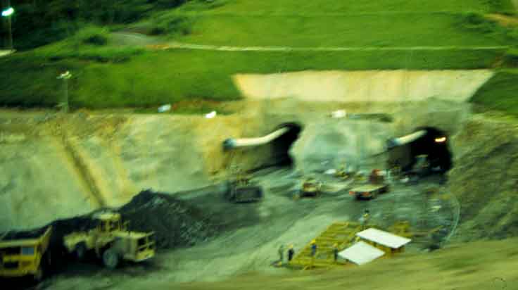
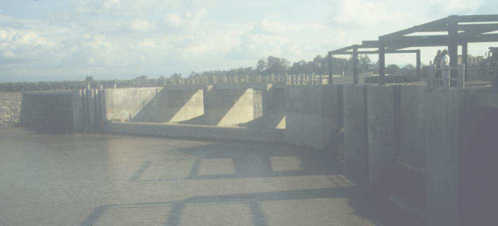
Recent attempts at reclaiming swamp lands: Top- Diversion tunnels of URRA I Multipurpose Hydroelectric Project, at upper Sinu river, Cordoba, Colombia. Its reservoir prevents the annual floods from feeding the natural depressions, but can't handle bigger, devastating floods. Bottom- Diversion gates at Manuel J. Calle, in Bulubulu river, of Bajo Guayas Project of CEDEGE, Guayas, Ecuador. These keep away the floodwaters from natural depressions, but dumps the water in a reserve of mangroves, killing them (Yapa, 1997) |
|
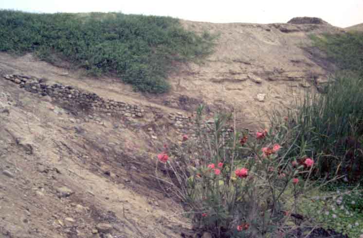
The techniques
mentioned above, collect water without directly blocking the
streams; damming stream flow in the American continent, known
for its intense rainstorms, triggered by El Niño events, demand
heavy precautions. That
did not deter, however, the ancient Ecuadorians, of the
peninsula of Santa Elena, who dotted its gentle hill slopes with
hundreds of albarradas, small ponds formed by earth dikes, laid across the
streams. Many of
those, even today, feed numerous springs and wells in the plains
below, because their designers acted with prudence: the streams
were blocked right where they are born, where they barely crawl.
An ongoing study corroborates another aspect of ancestral
wisdom: that, they located the albarradas,
only on permeable or semi-permeable ground (Álvarez et al,
2001), where infiltration is optimal.
The
engineers of the past also accepted the challenge, of blocking
larger streams: they built great pools of water at valley necks,
but only where the circumstances guaranteed, a structure that
would last. A large
such earthen dike, the 18-meter-high Purrón dam (Yapa, 2000),
in Puebla, Mexico, has a base width that would amaze a modern
engineer, almost 100 meters, which resisted successfully, the
erosive forces of the stream, for more than a millennium. The 1400-meter-long dam-aqueduct, of Ascope, in La Libertad,
Peru, created a lake of 22 million cubic meters (Deza, 1999),
and even El Niño rains could not overtop its earthen dike.
Many enormous dam-aqueducts, lay across north coast
streams of Peru, and none is equipped with a bottom outlet: may
be they all were designed to trap the inflow to nourish the
groundwater. The
huge lake, La Tapada,
located at the brim of Chongon-Colonche hills, above the
semi-arid, Las Balsas valley, in Ecuador, has a natural bottom
outlet; a voluminous spring, bubbling under the dam, whose
outflow filters-in at the valley neck and feeds the wells.
Apparently, the ancient inhabitants augmented the lake
volume, by raising the height of the naturally formed blockade,
to assure a year-round flow of water, and to prevent a
calamitous spillover during storm seasons. |
| The cross section of the Purrón dam, cut open later by arroyo Lencho Diego, in Tehuacan valley, Puebla, Mexico. Farming communities built this 800m long structure in several stages, during the period 750BC to 300AD (Woodbury & Neely, 1972). | 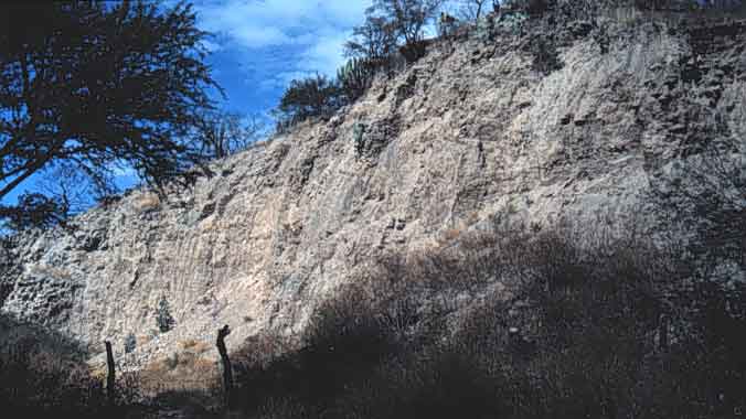 |
 |
The Ascope dam-aqueduct that created 'Alto Pichona' lake in Chicama valley, in La Libertad, Peru. Now, water remains only at the right edge of the basin. |
| 'La Tapada' lake, when full, covers a couple of square kilometers and sits above the comuna Las Balsas, in the peninsula of Santa Elena, Ecuador. |
|
|
Irrigation
in permeable or semi-permeable lands also recharges the
underground aquifers. The
great Chimú Empire, in the north coast of Peru, saturated the
Moche valley right bank, with many irrigation canals (Moseley,
1992), because their gargantuan capital city, Chan Chan, which
depended heavily on groundwater, lay down slope. Given these
ingenious, multi-faceted, and economical, American solutions to
the groundwater shortage, what technique, do you think, the
State of Arizona would adopt to solve their problem?
The most expensive of them all!
They would pump the Colorado River water over a ridge,
transfer it over hundreds of kilometers, through the
multi-million-dollar, Central Arizona Project canal, and then,
let the desert seep it in.
Fortunately,
some modern engineers look for cheaper alternatives, to trap
humidity in the ground. A
series of ‘polders,’ U-shaped low earth dikes, each pooling
several hectares of rainwater, built recently at the head of
gently sloping, coastal rice-belt of Guyana and Suriname, feeds
the paddies year-round. An
attempt by the Venezuelan Government, to adopt them to the
floodplains of Río Apure, caused havoc, because its technicians
did not have the patience, to observe the nature’s response,
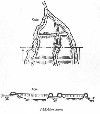
and modify the designs to suit. They wanted to trap runoff, in small ponds (termed módulos),
to grow pasture when the water recedes, but they had built so
many, so close and so fast, that water spilling over the upper módulos,
caused a ‘domino effect’ and completely destroyed the lower
dikes (Yapa, 1997). |
|
|
|
As planned for
the módulos of Apure,
cultivating within the drying reservoir constitutes the
simplest, and the most direct means of exploiting the soil
humidity. Many
desert farmers, like the Papago of Arizona, the albarrada users of Ecuador, or the bancada growers of coastal Peru, as well as the qocha
owners of Peruvian altiplano,
all plant their seeds at the edge of the water line, to get the
most out of their sweat. The
terrace farmers too make full use of freshly wet soil, if they
do not have irrigation facilities. Nevertheless, in
the extremely dry Peruvian littoral belt, where the evaporation,
in a matter of hours, erases without even a hint whatever
precipitation occurred, the farmers require a permanent supply
of humidity to sustain their plants. Hence, the constant pressure to build irrigation canals, to
cover every possible corner of the desert floor.
However, many rivers, upon entering the desert valley,
seek refuge in their thick beds of gravel, and run dry on the
surface, a situation quite common in the southern Peruvian
coast. Undeterred,
the Nasca farmers there have tunneled into the conglomerate
deposits, crisscrossing the riverbed, to capture the filtration.
These 'subterranean rivers' daylight into surface
reservoirs, and convert themselves into irrigation canals.
Some filtration galleries in Tehuacán Valley, of Puebla,
Mexico, penetrate the soft limestone deposits there as deep as
10 kilometers, to collect groundwater (Woodbury and Neely,
1972). |
|
|
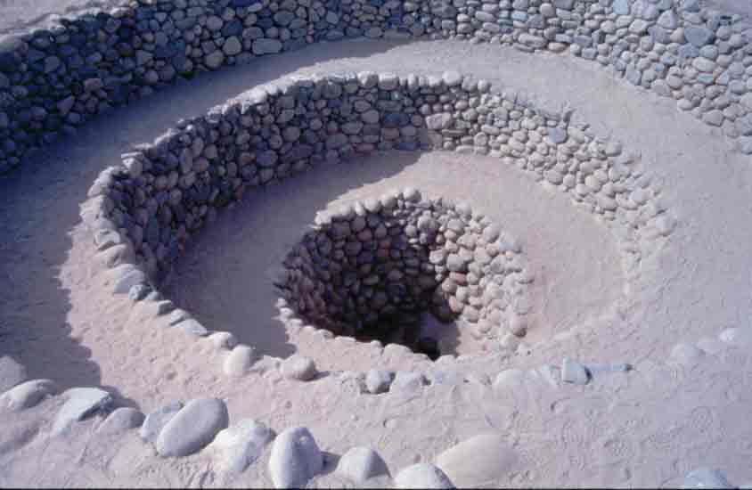
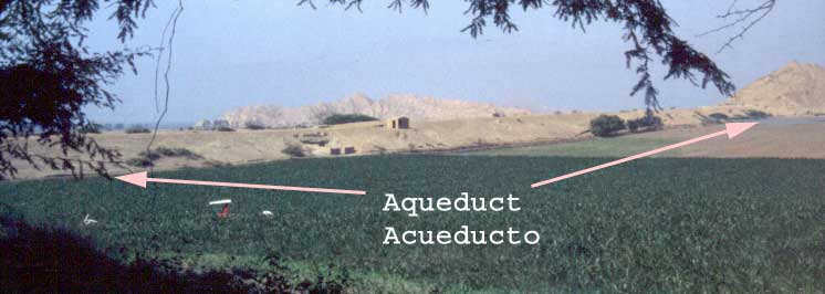
Left:
In total, 28
filtration galleries were built in the
Nasca valley since 600BC. Some, penetrate up to a kilometer, inside the hard
conglomerate deposits, and bring out up to 25 liters of water, per
second (González, 1978). Below: Planning far ahead into the future, the tunnel builders had invested substantial efforts in creating these beautifully cobble-lined, spirally descending, waste-removal wells, at about every 50m, that remain functional even today. |
|
|
|
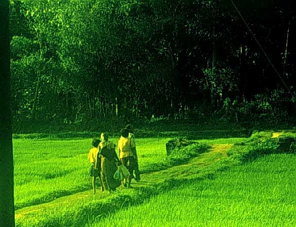
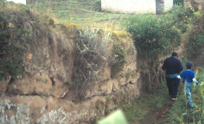
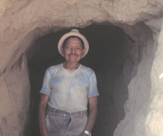
| Today's campesino
neither lags far, in the quest for water.
During a casual walk up the barren Andean slopes of
Riobamba, Ecuador, I stopped by a well-built terraced plot, to
chat with the farmer. “I really appreciate your efforts to preserve the past
agricultural techniques, like this ancient terrace wall...”
My praises were cut short, as Don Miguel Bravo corrected
me. “Well, that
wall only has a couple of years, and I built it on my own” he
said, and invited me up the hill.
“Still, long droughts ruin all my corn.
So I had to go in, looking for the ‘gold’…”
pointed the farmer-engineer his beaming face towards his
invention: a man-sized tunnel, dug some 50m into the cangagua hillside, bringing out a trickle directly to his cornfield. |
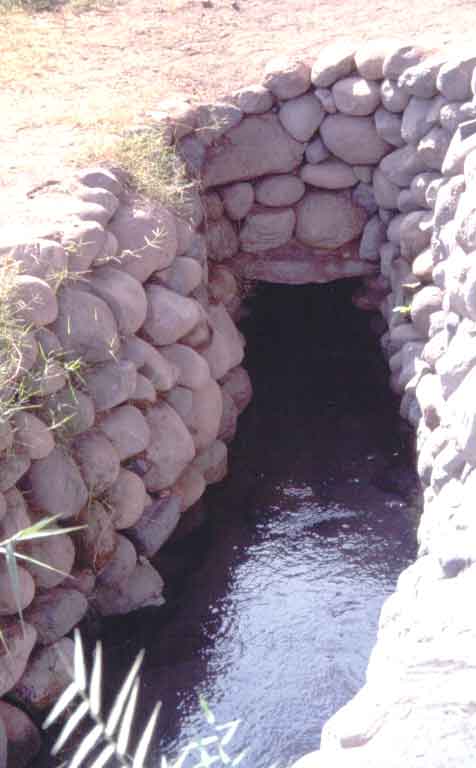
| Don Miguel Angel Bravo proudly poses at the entrance to his filtration gallery. (Cacha road, Riobamba, Ecuador - 1995) |
|
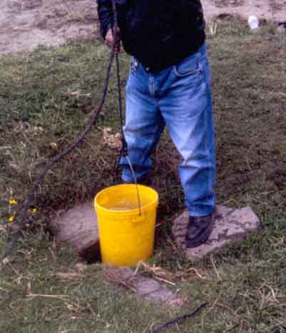
| Even when these
trickles dry out, the farmer would not give up: he would
dig-after the drop seeping-in, trying to reach where it rests
–the water table. Such
efforts, over a millennium, have pockmarked Peruvian coastal
valleys, with thousands of pits, called 'sunken gardens', each
10 to 40 meters wide, and 30 to100 meters long, a couple of
meters deeper than the natural ground, and bordered by wide
ridges of loose soil (Parsons, 1975).
Even the Spanish chroniclers, did not forget to mention
this ingenious water-table-farming system. Unfortunately, recent excessive groundwater pumping had
forced many, to abandon these lots.
A monumental version of sunken gardens, near Chan Chan,
the wachaques, greenish ‘pools’ covering many hectares of surface
area, beds artificially lowered by 8 to 10 meters, probably
provided fresh water and produce, for the Chimú royal courts.
Despite their coastal location, these gardens did not
suffer from saltwater intrusion, because their engineers knew,
that constant upslope irrigation, does suppress the layer of
brackish water at the coast. |
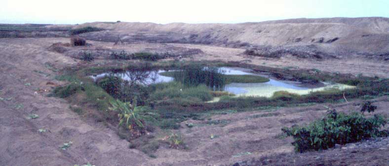 |
Wachaque chico, one of the two major sunken fields just outside the Chimú city of Chan Chan, Trujillo, Peru, built around 1250-1400AD. People grew vegetables in these, even in 1980, but were obliged to pump irrigate them (Topic y Topic, 1980). |
| The 10m deep side slope is protected by a cobble masonry wall, that prevents slide failures of sandy soil. | 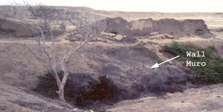 |
 |
Left: Much bigger, wachaque grande extends towards
the beach, at the far end. Below: Sunken fields within Chan Chan city walls; "pleasure gardens?" |
|
|
|
|
Many of these
traditional technologies, that exploit groundwater, truly follow
the basic engineering principles: the efficient use of resources
and the effectiveness of the system.
Yes, they require significant initial investments,
mainly, organized manual labor. The traditional societies could muster such resources,
without negatively affecting the daily routines, through the
obligatory community service work.
Once in place, these engineering schemes needed no
operating expenses, only routine maintenance, which, again, the
community service could handle very easily.
And their effectiveness? The continuing existence of many
schemes readily demonstrates that.
Why don’t we
apply the same measures to evaluate the modern projects?
Let’s see.
What do you think, how would the State of Arizona
exploit, the Colorado River water, it pumped over and stored in
the desert? You guessed
right: by pumping it out! I rest my case. -September
2001. Guayaquil,
Ecuador. |
References: |
|
Álvarez,
Silvia G. et al (2001) “Albarradas:
Un conocimiento ancestral y una solución práctica a los
eventos de El Niño,” Informe preliminar, Proyecto Albarradas,
Escuela de arqueología, ESPOL, Guayaquil, Ecuador. Alzate P., Alberto, et al (1987) “Impactos sociales del Proyecto Hidroeléctrico de URRA” Fundación del Caribe, Montería, Colombia. CEDEGE
(1994) “Diseños definitivos de drenaje de la cuenca baja del
río Guayas - Estudios de impactos ambientales: Diagnostico
ambiental y evaluación de impactos” Informe de Asociación
Haskoning, Fagromen, Consulsísmica y Sísmica a CEDEGE,
Guayaquil, Ecuador, julio. Cordell, Linda S. (1984) “Prehistory of the Southwest” Academic Press, USA. Denevan,
William M. (1980) “Tipología de configuraciones agrícolas
prehispánicas,” América Indígena, vol. 40, #4, p 619-651. Deza
Rivasplata, Jaime M. (1999) “Manejo prehispánico del agua en
la costa norte peruana: continuidad de los sistemas,” Escuela
de arqueología, Universidad Nacional de Trujillo, Trujillo, Perú. Flores,
Jorge A. y Percy Paz Flores (1983) “El cultivo en qocha en la
puna sur Andina”, en Evolución y tecnología de la
agricultura andina, Ed: Ana María Fries, IICA/I.I.I., Cusco,
Perú. p 44-85. González
García, M. Francisco (1978) “Los acueductos incaicos de Nazca”
en Tecnología Andina, ed: Rogger Ravines, Instituto de
Estudios Peruanos, Lima, Perú, p 129-156. Matheny, Raymond T. (1982) “Ancient lowland and highland Maya water and soil conservation strategies” in Maya subsistence, Ed: Kent V. Flannery, Academic Press, NY, USA, p 157-178. Moseley, Michael E. (1992) “The Incas and their ancestors” Thames and Hudson, London. Parsons, Jeffrey R. and Norbert P. Psuty (1975) “Sunken fields and prehispanic subsistence on the Peruvian coast,” American Antiquity, vol. 40, #3, p259-282. Pérez
Calderón, Ismael (1999) “Huari: mistoriosa ciudad de piedra”
Facultad de Ciencias Sociales, Universidad Nacional de San Cristóbal
de Huamanga, Ayacucho, Perú. Reid, J and S. Whittlesey (1997) “The archaeology of ancient Arizona,” University of Arizona Press, Tucson, AZ, USA. Topic, John R. and Theresa L. Topic (1992) “The rise and decline of Cerro Amaru: an Andean shrine during the early intermediate period and middle horizon” in Ancient images, ancient thought: the archaeology of ideology, Ed: A. Sean Goldsmith et al, Univ. of Calgary archaeological association, Calgary, Cananda, p 167-180. Topic,
Theresa L y John R. Topic (1980) “Arquitectura en Chan Chan”
en Chan Chan: Chimú Metropoli, ed: Rogger Ravines,
Institute de Estudios Peruanos, Lima, Perú. Woodbury, Richard B. and James A. Neely (1972) “Water control systems of the Tehuacán valley” in The prehistory of the Tehuacán valley, Ed: Richard MacNeish, vol. 4, Univ. of Texas Press, Austin, TX, USA, p 81-153. Wulff, H. E. (1968)
“The qanats of Iran” Scientific American, vol 218:4, p.
94-105, April. Yapa,
Kashyapa A.S. (1997) “La ingeniería prehispánica Americana y
sus lecciones para hoy,” http://kyapa.tripod.com Yapa, Kashyapa A.S. (2000) “An encounter with the engineers of the past,” http://kyapa.tripod.com |
If you would like to begin a discussion, please, write to me |