|
|
A PHOTO GALLERY By Kashyapa A. S. Yapa |
|
CONTENT: PART I System Maps - Phoenix/ Lambayeque/ Chicama/ Earthen
canals - Pueblogrande/
Taymi/ Apurlec/ Ascope / Pacherrez /Huari Rock-cut canal - Cumbemayo Lined canals - Intervalley/ Raqchi/ Yucay/ Tipon Fossilized canals – Tehuacan/ Moctezuma Aqueducts
- Ascope/ Intervalley/ Piquillakta / Tipon Tunnels - Ibarra/ Mira Related structures: Spills – Ascope/ Intervalley Erosion protection - Intervalley Secondary canal – Intervalley Field canals – Chan Chan |
| Large canal systems: |
|
| This map, from Deza (1999), identifies major canals that lead from Lambayeque (or Chancay) river, in the north coast of Peru. Thick dark lines indicate canals, and shaded areas, some of the irrigated areas. Some canals still function, in slightly modified forms. (The scale, shown at bottom left, is 10km.) | 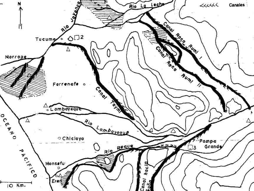 |
|
|
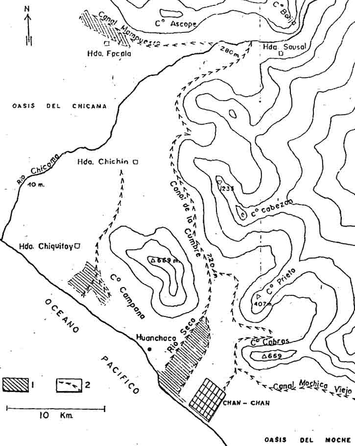
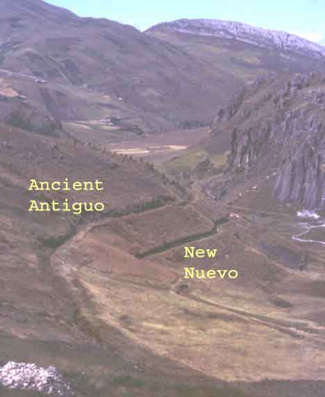
The trajectory of the Chicama-Moche intervalley canal (canal de la cumbre) is shown here (Deza, 1999). Built by Chimu empire, it ran from Sausal to Chan Chan, some 70 plus kilometers, crossing the valley divide, to augment the unpredictable supply of Moche river. Whether it actually brought water to Moche valley, has not been confirmed yet. The map, also shows some other canals that lead from Rio Chicama, towards Ascope and towards Chiquitoy. Shaded, are some of the irrigated areas. |
| Major Earthen Canals |
| One of the major Hohokam canals, near Pueblo Grande Museum, Phoenix, AZ, USA. It is very wide and deep at this point, closer to the intake. | 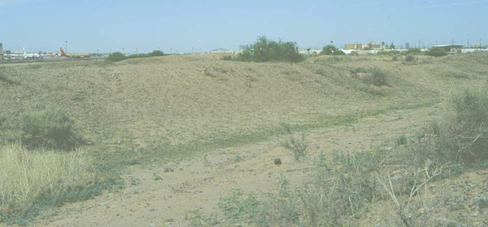 |
|
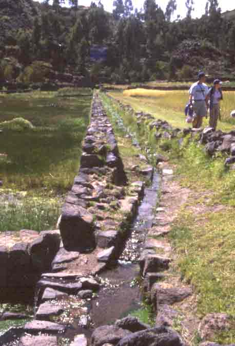
Taymi canal, near Patapo, Lambayeque, Peru, one of the major canals in the Lambayeque valley. A new concrete lined canal, replaced this, a few decades ago. |
|
A smaller, but longer, canal, leaving from the left bank of Lambayeque river, at Pacherrez, near Pampa Grande, which was the last capital of Moche culture. Now it carries the runoff coming down the hill, protecting the village below. |
|
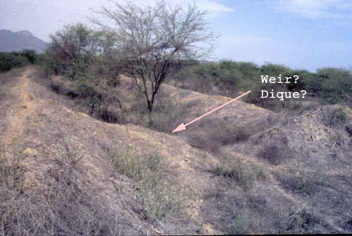 |
A large transbasin canal at Apurlec, fed by La Leche river, north of Lambayeque, Peru. It probably had a weir to control the flow. The whole system has long been abandoned. |
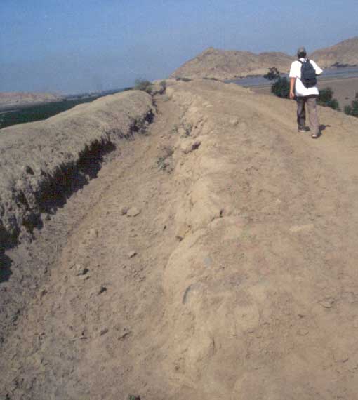
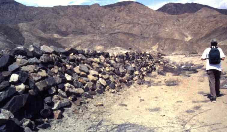
| This canal, turns north from Chicama river, and runs on top of the Ascope dam-aqueduct, in La Libertad, Peru. It had been in use, till the beginning of the last century, when the sugarcane moguls destroyed the structure. Modern canals, run at the foot of the dam, and thus, are unable to feed lands in the upper valley. To the far right is the lake 'Alto Pichona,' formed by the dam. |
|
|
|
A small canal, bringing spring water from higher elevations, to the ancient Huari capital, near Ayacucho, Peru. In this stretch, it runs over an earth and rock aqueduct. |
| Rock-cut Canals |
|
|
|
|
|
|
|
|
|
| Lined Canals: |
 |
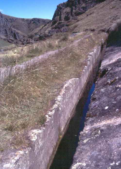
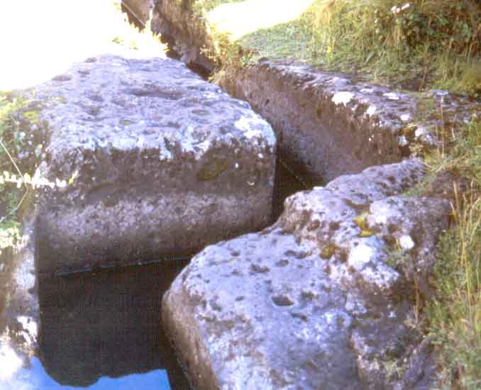
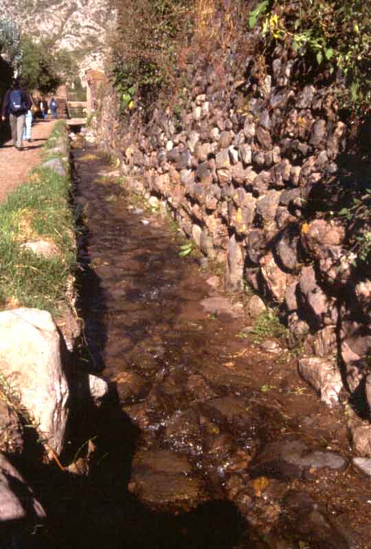
Moche-Chicama intervalley canal, in La Libertad, Peru, has an excellent rock masonry lining. |
| The masonry lining extends for kilometers. | 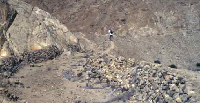 |
 |
The valley-side bund of the canal, built up with rock walls. In the background of the photo, the steep valley-side slope is masterfully terraced to prevent erosion. |
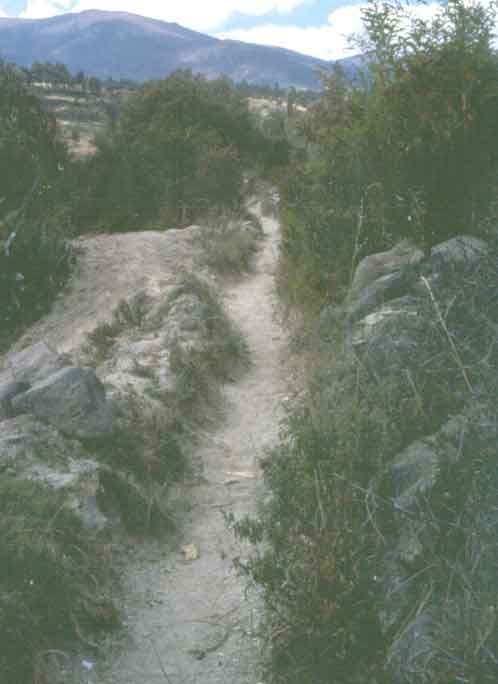
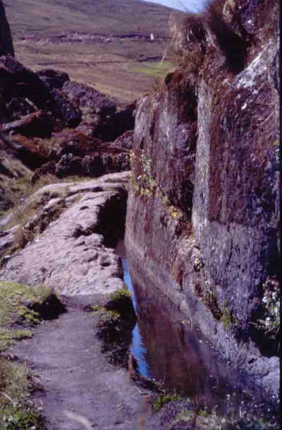
| A snow-melt stream that reaches Urubamba valley at Yucay, near Ollantaytambo, Cusco, Peru, was subjected to a master-planned water management system. Just above the Yucay valley neck, the Incas, converted the fast-running stream to a fully stone-lined canal, and divided it into several branches, to feed the massive, stone-terraced agricultural fields, that cover the entire valley. This canal collects overflow from the terraces on the right, while feeding those on the left on its run down to the river. Canal bottoms too, are lined with well-fitted, large, field stones. |
|
|
|
This small, well-lined canal, at Raqchi, near Sicuani, Cusco, Peru, brought water for domestic or ceremonial purposes. |
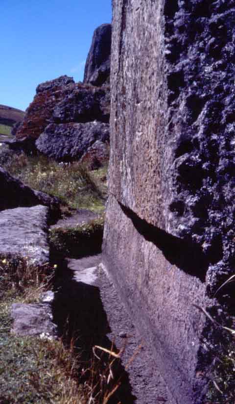
| This cut-stone-lined canal, at Tipon, upper Urubamba valley, Cusco, Peru, brought water for ceremonial purposes, at the Intihuatana, that watches over the extensive terraced fields below. A separate irrigation system fed the fields.. |
|
|
PART II If you would like to begin a discussion, please, write to me. |